
geoai
GeoAI: Artificial Intelligence for Geospatial Data
Stars: 692
geoai is a Python package designed for utilizing Artificial Intelligence (AI) in the context of geospatial data. It allows users to visualize various types of geospatial data such as vector, raster, and LiDAR data. Additionally, the package offers functionalities for segmenting remote sensing imagery using the Segment Anything Model and classifying remote sensing imagery with deep learning models. With a focus on geospatial AI applications, geoai provides a versatile tool for processing and analyzing spatial data with the power of AI.
README:


![]()
A powerful Python package for integrating Artificial Intelligence with geospatial data analysis and visualization
GeoAI bridges the gap between AI and geospatial analysis, providing tools for processing, analyzing, and visualizing geospatial data using advanced machine learning techniques. Whether you're working with satellite imagery, LiDAR point clouds, or vector data, GeoAI offers intuitive interfaces to apply cutting-edge AI models.
- 📖 Documentation: https://geoai.gishub.org
- 💬 Community: GitHub Discussions
- 🐛 Issue Tracker: GitHub Issues
❗ Important notes: The GeoAI package is under active development and new features are being added regularly. Not all features listed below are available in the current release. If you have a feature request or would like to contribute, please let us know!
- Interactive multi-layer visualization of vector, raster, and point cloud data
- Customizable styling and symbology
- Time-series data visualization capabilities
- Streamlined access to satellite and aerial imagery from providers like Sentinel, Landsat, NAIP, and other open datasets
- Tools for downloading, mosaicking, and preprocessing remote sensing data
- Automated generation of training datasets with image chips and corresponding labels
- Vector-to-raster and raster-to-vector conversion utilities optimized for AI workflows
- Data augmentation techniques specific to geospatial data
- Support for integrating Overture Maps data and other open datasets for training and validation
- Integration with Meta's Segment Anything Model (SAM) for automatic feature extraction
- Specialized segmentation algorithms optimized for satellite and aerial imagery
- Streamlined workflows for segmenting buildings, roads, vegetation, and water bodies
- Export capabilities to standard geospatial formats (GeoJSON, Shapefile, GeoPackage, GeoParquet)
- Pre-trained models for land cover and land use classification
- Transfer learning utilities for fine-tuning models with your own data
- Multi-temporal classification support for change detection
- Accuracy assessment and validation tools
- Terrain analysis with AI-enhanced feature extraction
- Point cloud classification and segmentation
- Object detection in aerial and satellite imagery
- Georeferencing utilities for AI model outputs
pip install geoai-pyconda install -c conda-forge geoaimamba install -c conda-forge geoaiComprehensive documentation is available at https://geoai.gishub.org, including:
- Detailed API reference
- Tutorials and example notebooks
- Explanation of algorithms and models
- Best practices for geospatial AI
Check out our YouTube channel for video tutorials on using GeoAI for geospatial data analysis and visualization.
We welcome contributions of all kinds! See our contributing guide for ways to get started.
GeoAI is free and open source software, licensed under the MIT License.
For Tasks:
Click tags to check more tools for each tasksFor Jobs:
Alternative AI tools for geoai
Similar Open Source Tools
geoai
geoai is a Python package designed for utilizing Artificial Intelligence (AI) in the context of geospatial data. It allows users to visualize various types of geospatial data such as vector, raster, and LiDAR data. Additionally, the package offers functionalities for segmenting remote sensing imagery using the Segment Anything Model and classifying remote sensing imagery with deep learning models. With a focus on geospatial AI applications, geoai provides a versatile tool for processing and analyzing spatial data with the power of AI.
openvino
OpenVINO™ is an open-source toolkit for optimizing and deploying AI inference. It provides a common API to deliver inference solutions on various platforms, including CPU, GPU, NPU, and heterogeneous devices. OpenVINO™ supports pre-trained models from Open Model Zoo and popular frameworks like TensorFlow, PyTorch, and ONNX. Key components of OpenVINO™ include the OpenVINO™ Runtime, plugins for different hardware devices, frontends for reading models from native framework formats, and the OpenVINO Model Converter (OVC) for adjusting models for optimal execution on target devices.
magic
Magic is an open-source all-in-one AI productivity platform designed to help enterprises quickly build and deploy AI applications, aiming for a 100x increase in productivity. It consists of various AI products and infrastructure tools, such as Super Magic, Magic IM, Magic Flow, and more. Super Magic is a general-purpose AI Agent for complex task scenarios, while Magic Flow is a visual AI workflow orchestration system. Magic IM is an enterprise-grade AI Agent conversation system for internal knowledge management. Teamshare OS is a collaborative office platform integrating AI capabilities. The platform provides cloud services, enterprise solutions, and a self-hosted community edition for users to leverage its features.
refly
Refly.AI is an open-source AI-native creation engine that empowers users to transform ideas into production-ready content. It features a free-form canvas interface with multi-threaded conversations, knowledge base integration, contextual memory, intelligent search, WYSIWYG AI editor, and more. Users can leverage AI-powered capabilities, context memory, knowledge base integration, quotes, and AI document editing to enhance their content creation process. Refly offers both cloud and self-hosting options, making it suitable for individuals, enterprises, and organizations. The tool is designed to facilitate human-AI collaboration and streamline content creation workflows.
fluid
Fluid is an open source Kubernetes-native Distributed Dataset Orchestrator and Accelerator for data-intensive applications, such as big data and AI applications. It implements dataset abstraction, scalable cache runtime, automated data operations, elasticity and scheduling, and is runtime platform agnostic. Key concepts include Dataset and Runtime. Prerequisites include Kubernetes version > 1.16, Golang 1.18+, and Helm 3. The tool offers features like accelerating remote file accessing, machine learning, accelerating PVC, preloading dataset, and on-the-fly dataset cache scaling. Contributions are welcomed, and the project is under the Apache 2.0 license with a vendor-neutral approach.
xpert
Xpert is a powerful tool for data analysis and visualization. It provides a user-friendly interface to explore and manipulate datasets, perform statistical analysis, and create insightful visualizations. With Xpert, users can easily import data from various sources, clean and preprocess data, analyze trends and patterns, and generate interactive charts and graphs. Whether you are a data scientist, analyst, researcher, or student, Xpert simplifies the process of data analysis and visualization, making it accessible to users with varying levels of expertise.
ML
Rubix ML is a high-level machine learning and deep learning library for the PHP language. It provides a developer-friendly API with over 40 supervised and unsupervised learning algorithms, support for ETL, preprocessing, and cross-validation. The library is open source and free to use commercially. Rubix ML allows users to build machine learning programs in PHP, covering the entire machine learning life cycle from data processing to training and production. It also offers tutorials and educational content to help users get started with machine learning projects.
fenic
fenic is an opinionated DataFrame framework from typedef.ai for building AI and agentic applications. It transforms unstructured and structured data into insights using familiar DataFrame operations enhanced with semantic intelligence. With support for markdown, transcripts, and semantic operators, plus efficient batch inference across various model providers. fenic is purpose-built for LLM inference, providing a query engine designed for AI workloads, semantic operators as first-class citizens, native unstructured data support, production-ready infrastructure, and a familiar DataFrame API.
StratosphereLinuxIPS
Slips is a powerful endpoint behavioral intrusion prevention and detection system that uses machine learning to detect malicious behaviors in network traffic. It can work with network traffic in real-time, PCAP files, and network flows from tools like Suricata, Zeek/Bro, and Argus. Slips threat detection is based on machine learning models, threat intelligence feeds, and expert heuristics. It gathers evidence of malicious behavior and triggers alerts when enough evidence is accumulated. The tool is Python-based and supported on Linux and MacOS, with blocking features only on Linux. Slips relies on Zeek network analysis framework and Redis for interprocess communication. It offers a graphical user interface for easy monitoring and analysis.
joliGEN
JoliGEN is an integrated framework for training custom generative AI image-to-image models. It implements GAN, Diffusion, and Consistency models for various image translation tasks, including domain and style adaptation with conservation of semantics. The tool is designed for real-world applications such as Controlled Image Generation, Augmented Reality, Dataset Smart Augmentation, and Synthetic to Real transforms. JoliGEN allows for fast and stable training with a REST API server for simplified deployment. It offers a wide range of options and parameters with detailed documentation available for models, dataset formats, and data augmentation.
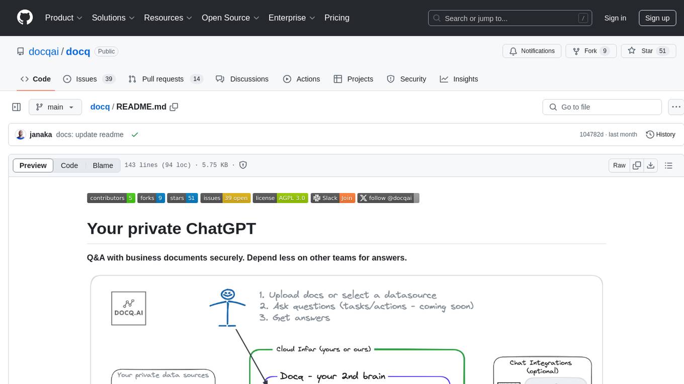
docq
Docq is a private and secure GenAI tool designed to extract knowledge from business documents, enabling users to find answers independently. It allows data to stay within organizational boundaries, supports self-hosting with various cloud vendors, and offers multi-model and multi-modal capabilities. Docq is extensible, open-source (AGPLv3), and provides commercial licensing options. The tool aims to be a turnkey solution for organizations to adopt AI innovation safely, with plans for future features like more data ingestion options and model fine-tuning.
ai-platform-engineering
The AI Platform Engineering repository provides a collection of tools and resources for building and deploying AI models. It includes libraries for data preprocessing, model training, and model serving. The repository also contains example code and tutorials to help users get started with AI development. Whether you are a beginner or an experienced AI engineer, this repository offers valuable insights and best practices to streamline your AI projects.
suna
Kortix is an open-source platform designed to build, manage, and train AI agents for various tasks. It allows users to create autonomous agents, from general-purpose assistants to specialized automation tools. The platform offers capabilities such as browser automation, file management, web intelligence, system operations, API integrations, and agent building tools. Users can create custom agents tailored to specific domains, workflows, or business needs, enabling tasks like research & analysis, browser automation, file & document management, data processing & analysis, and system administration.
raif
Raif is a lightweight Python library for analyzing text data. It provides functionalities for text preprocessing, feature extraction, and text classification. With Raif, users can easily clean and preprocess text data, extract relevant features, and build machine learning models for text classification tasks. The library is designed to be user-friendly and efficient, making it suitable for both beginners and experienced data scientists.
dify
Dify is an open-source LLM app development platform that combines AI workflow, RAG pipeline, agent capabilities, model management, observability features, and more. It allows users to quickly go from prototype to production. Key features include: 1. Workflow: Build and test powerful AI workflows on a visual canvas. 2. Comprehensive model support: Seamless integration with hundreds of proprietary / open-source LLMs from dozens of inference providers and self-hosted solutions. 3. Prompt IDE: Intuitive interface for crafting prompts, comparing model performance, and adding additional features. 4. RAG Pipeline: Extensive RAG capabilities that cover everything from document ingestion to retrieval. 5. Agent capabilities: Define agents based on LLM Function Calling or ReAct, and add pre-built or custom tools. 6. LLMOps: Monitor and analyze application logs and performance over time. 7. Backend-as-a-Service: All of Dify's offerings come with corresponding APIs for easy integration into your own business logic.
ClicShopping
ClicShopping AI™ is an open-source Ecommerce platform powered by Generative AI, designed for B2B, B2C, and B2B-B2C businesses. It offers seamless shopping experiences, advanced AI integration, modular architecture for customization, and responsive design across devices. With features like GPT API integration, RAG-powered Business Intelligence Agent, multi-model AI support, and security compliance, ClicShopping AI™ is a comprehensive solution for online businesses. It also provides internationalization support, performance analytics, server performance optimization, content management, API connections, shipping and payment options, and a marketplace for additional modules and apps.
For similar tasks
geoai
geoai is a Python package designed for utilizing Artificial Intelligence (AI) in the context of geospatial data. It allows users to visualize various types of geospatial data such as vector, raster, and LiDAR data. Additionally, the package offers functionalities for segmenting remote sensing imagery using the Segment Anything Model and classifying remote sensing imagery with deep learning models. With a focus on geospatial AI applications, geoai provides a versatile tool for processing and analyzing spatial data with the power of AI.
superagent
Superagent is an open-source AI assistant framework and API that allows developers to add powerful AI assistants to their applications. These assistants use large language models (LLMs), retrieval augmented generation (RAG), and generative AI to help users with a variety of tasks, including question answering, chatbot development, content generation, data aggregation, and workflow automation. Superagent is backed by Y Combinator and is part of YC W24.
Awesome-Segment-Anything
Awesome-Segment-Anything is a powerful tool for segmenting and extracting information from various types of data. It provides a user-friendly interface to easily define segmentation rules and apply them to text, images, and other data formats. The tool supports both supervised and unsupervised segmentation methods, allowing users to customize the segmentation process based on their specific needs. With its versatile functionality and intuitive design, Awesome-Segment-Anything is ideal for data analysts, researchers, content creators, and anyone looking to efficiently extract valuable insights from complex datasets.
simpletransformers
Simple Transformers is a library based on the Transformers library by HuggingFace, allowing users to quickly train and evaluate Transformer models with only 3 lines of code. It supports various tasks such as Information Retrieval, Language Models, Encoder Model Training, Sequence Classification, Token Classification, Question Answering, Language Generation, T5 Model, Seq2Seq Tasks, Multi-Modal Classification, and Conversational AI.
smile
Smile (Statistical Machine Intelligence and Learning Engine) is a comprehensive machine learning, NLP, linear algebra, graph, interpolation, and visualization system in Java and Scala. It covers every aspect of machine learning, including classification, regression, clustering, association rule mining, feature selection, manifold learning, multidimensional scaling, genetic algorithms, missing value imputation, efficient nearest neighbor search, etc. Smile implements major machine learning algorithms and provides interactive shells for Java, Scala, and Kotlin. It supports model serialization, data visualization using SmilePlot and declarative approach, and offers a gallery showcasing various algorithms and visualizations.
pgai
pgai simplifies the process of building search and Retrieval Augmented Generation (RAG) AI applications with PostgreSQL. It brings embedding and generation AI models closer to the database, allowing users to create embeddings, retrieve LLM chat completions, reason over data for classification, summarization, and data enrichment directly from within PostgreSQL in a SQL query. The tool requires an OpenAI API key and a PostgreSQL client to enable AI functionality in the database. Users can install pgai from source, run it in a pre-built Docker container, or enable it in a Timescale Cloud service. The tool provides functions to handle API keys using psql or Python, and offers various AI functionalities like tokenizing, detokenizing, embedding, chat completion, and content moderation.
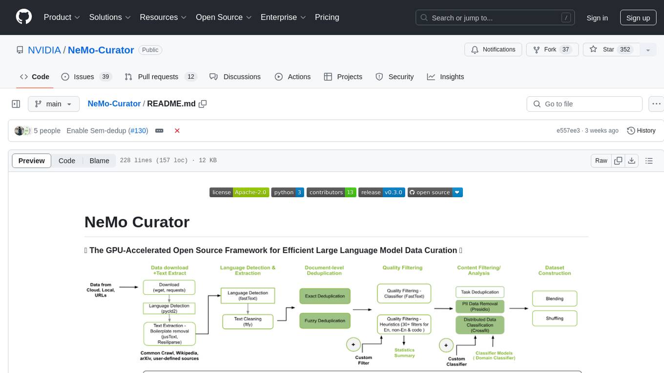
NeMo-Curator
NeMo Curator is a GPU-accelerated open-source framework designed for efficient large language model data curation. It provides scalable dataset preparation for tasks like foundation model pretraining, domain-adaptive pretraining, supervised fine-tuning, and parameter-efficient fine-tuning. The library leverages GPUs with Dask and RAPIDS to accelerate data curation, offering customizable and modular interfaces for pipeline expansion and model convergence. Key features include data download, text extraction, quality filtering, deduplication, downstream-task decontamination, distributed data classification, and PII redaction. NeMo Curator is suitable for curating high-quality datasets for large language model training.
bootcamp_machine-learning
Bootcamp Machine Learning is a one-week program designed by 42 AI to teach the basics of Machine Learning. The curriculum covers topics such as linear algebra, statistics, regression, classification, and regularization. Participants will learn concepts like gradient descent, hypothesis modeling, overfitting detection, logistic regression, and more. The bootcamp is ideal for individuals with prior knowledge of Python who are interested in diving into the field of artificial intelligence.
For similar jobs
weave
Weave is a toolkit for developing Generative AI applications, built by Weights & Biases. With Weave, you can log and debug language model inputs, outputs, and traces; build rigorous, apples-to-apples evaluations for language model use cases; and organize all the information generated across the LLM workflow, from experimentation to evaluations to production. Weave aims to bring rigor, best-practices, and composability to the inherently experimental process of developing Generative AI software, without introducing cognitive overhead.
agentcloud
AgentCloud is an open-source platform that enables companies to build and deploy private LLM chat apps, empowering teams to securely interact with their data. It comprises three main components: Agent Backend, Webapp, and Vector Proxy. To run this project locally, clone the repository, install Docker, and start the services. The project is licensed under the GNU Affero General Public License, version 3 only. Contributions and feedback are welcome from the community.
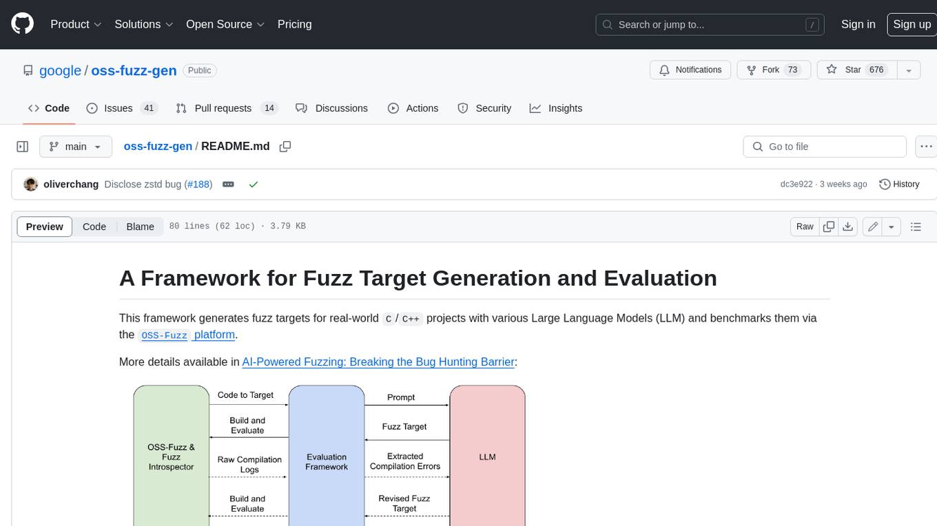
oss-fuzz-gen
This framework generates fuzz targets for real-world `C`/`C++` projects with various Large Language Models (LLM) and benchmarks them via the `OSS-Fuzz` platform. It manages to successfully leverage LLMs to generate valid fuzz targets (which generate non-zero coverage increase) for 160 C/C++ projects. The maximum line coverage increase is 29% from the existing human-written targets.
LLMStack
LLMStack is a no-code platform for building generative AI agents, workflows, and chatbots. It allows users to connect their own data, internal tools, and GPT-powered models without any coding experience. LLMStack can be deployed to the cloud or on-premise and can be accessed via HTTP API or triggered from Slack or Discord.
VisionCraft
The VisionCraft API is a free API for using over 100 different AI models. From images to sound.
kaito
Kaito is an operator that automates the AI/ML inference model deployment in a Kubernetes cluster. It manages large model files using container images, avoids tuning deployment parameters to fit GPU hardware by providing preset configurations, auto-provisions GPU nodes based on model requirements, and hosts large model images in the public Microsoft Container Registry (MCR) if the license allows. Using Kaito, the workflow of onboarding large AI inference models in Kubernetes is largely simplified.
PyRIT
PyRIT is an open access automation framework designed to empower security professionals and ML engineers to red team foundation models and their applications. It automates AI Red Teaming tasks to allow operators to focus on more complicated and time-consuming tasks and can also identify security harms such as misuse (e.g., malware generation, jailbreaking), and privacy harms (e.g., identity theft). The goal is to allow researchers to have a baseline of how well their model and entire inference pipeline is doing against different harm categories and to be able to compare that baseline to future iterations of their model. This allows them to have empirical data on how well their model is doing today, and detect any degradation of performance based on future improvements.
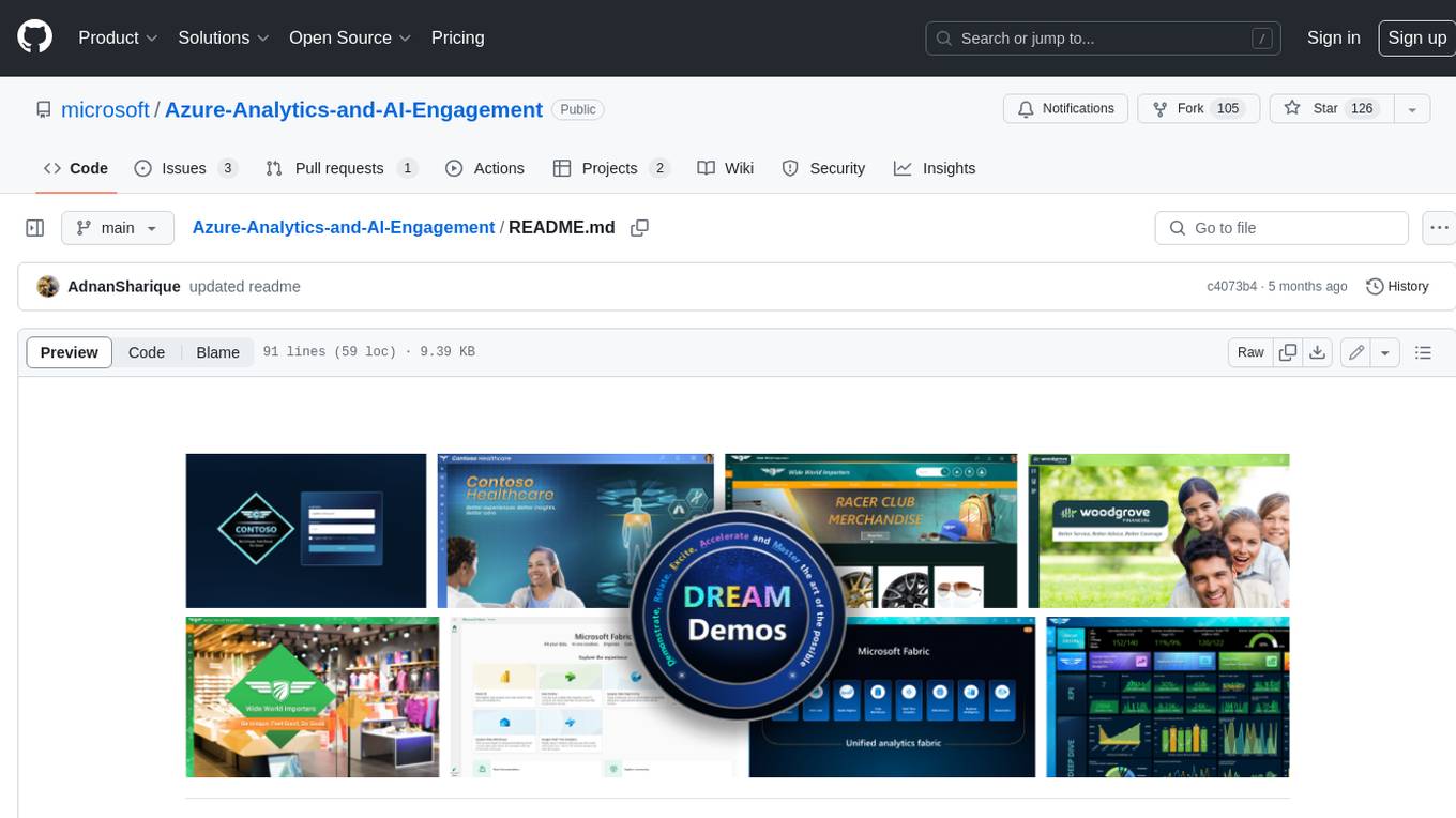
Azure-Analytics-and-AI-Engagement
The Azure-Analytics-and-AI-Engagement repository provides packaged Industry Scenario DREAM Demos with ARM templates (Containing a demo web application, Power BI reports, Synapse resources, AML Notebooks etc.) that can be deployed in a customer’s subscription using the CAPE tool within a matter of few hours. Partners can also deploy DREAM Demos in their own subscriptions using DPoC.